2. Methods and results
One of the methods for obtaining field data on partially preserved architectural heritage objects was 3D-scanning and aerial photography technology, using advanced technical means (laser scanner, copter). As examples of 3D-models made by different methods, this work presents the reconstruction of Prince Vladimir temple (17th – 18th centuries), the ensemble of the Ivanovsky Monastery (17th – 18th cc.) as well as the house (chamber) of A.F. Lopukhin, brother of Tsarina Evdokia Feodorovna, the first wife of Tsar Peter I. The identified sources allow us to offer verifiable reconstructions of their external appearance. However, in some cases, these models have a certain degree of convention, a reliable reconstruction of the space-planning composition of buildings can be combined with borrowing from analogs (Nocerino 2012).
In 2020, a 3D-scanning of the facades of the Vladimir temple (existing currently in a modified form) was carried out. Leica BLK 360 laser scanner was used. A large number of 3D-scanning points (73.7 million points) in the course of work made it possible to capture not only the exact appearance of the building, but also a large volume of the surrounding area of the temple. 3D-model of the temple appearance obtained from the point cloud was used to create a virtual reconstruction of the Vladimir temple based on retrospection techniques (Fig. 1). In hard-to-reach locations, where the capabilities of the laser scanner were limited (especially on the roof of the temple), it was necessary to conduct a combined survey of the temple also on a DJI Phantom 4 Standart unmanned aerial vehicle (UAV) (Fig. 2), with the subsequent construction of a point cloud based on aerial photography materials, combining two point clouds with each other and creating a 3D-model of the current state of the temple in the Agisoft Metashape program. The reconstruction of the 17th century temple was carried out on the basis of its existing appearance, which made it possible to present the retrospective evolution of the temple from its present state to its original forms. The ArchiCAD program was used as the main tool for constructing a virtual reconstruction of the Bely Gorod buildings (see 3D-model of the temple at Fig. 3 and the Lopukhin chamber, Fig. 4).
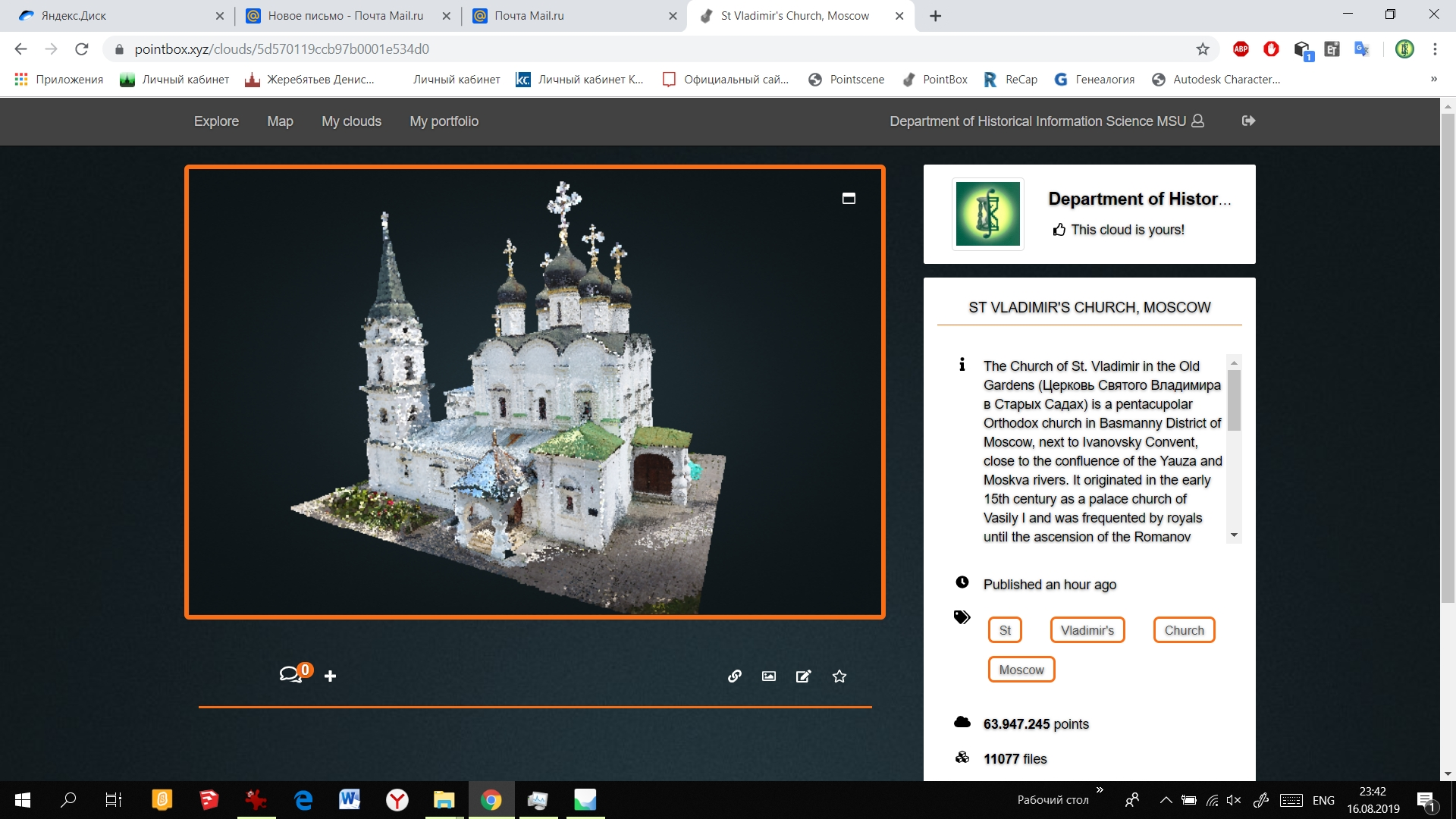
Fig. 1. Reconstruction by point cloud (laser scanning) of the Temple of Prince Vladimir on the Pointbox site
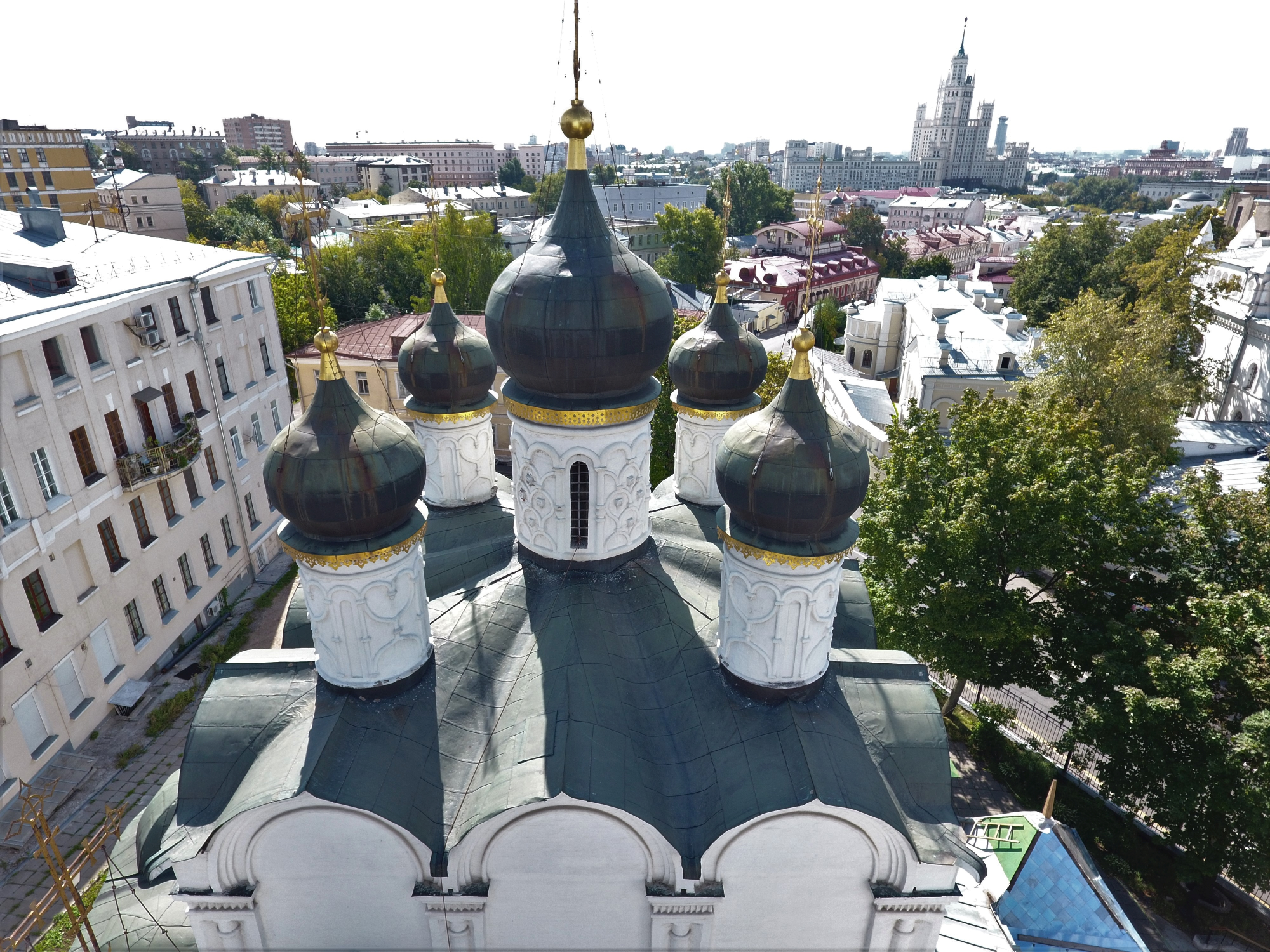
Fig. 2. View of the dome of the temple of Prince Vladimir from a quadcopter
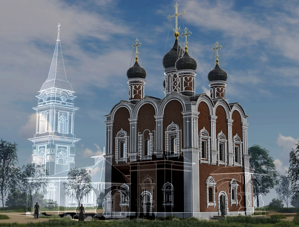
Fig. 3. Visualization of the virtual reconstruction of the temple of Prince Vladimir (evolution from 17th to 18th cc.)
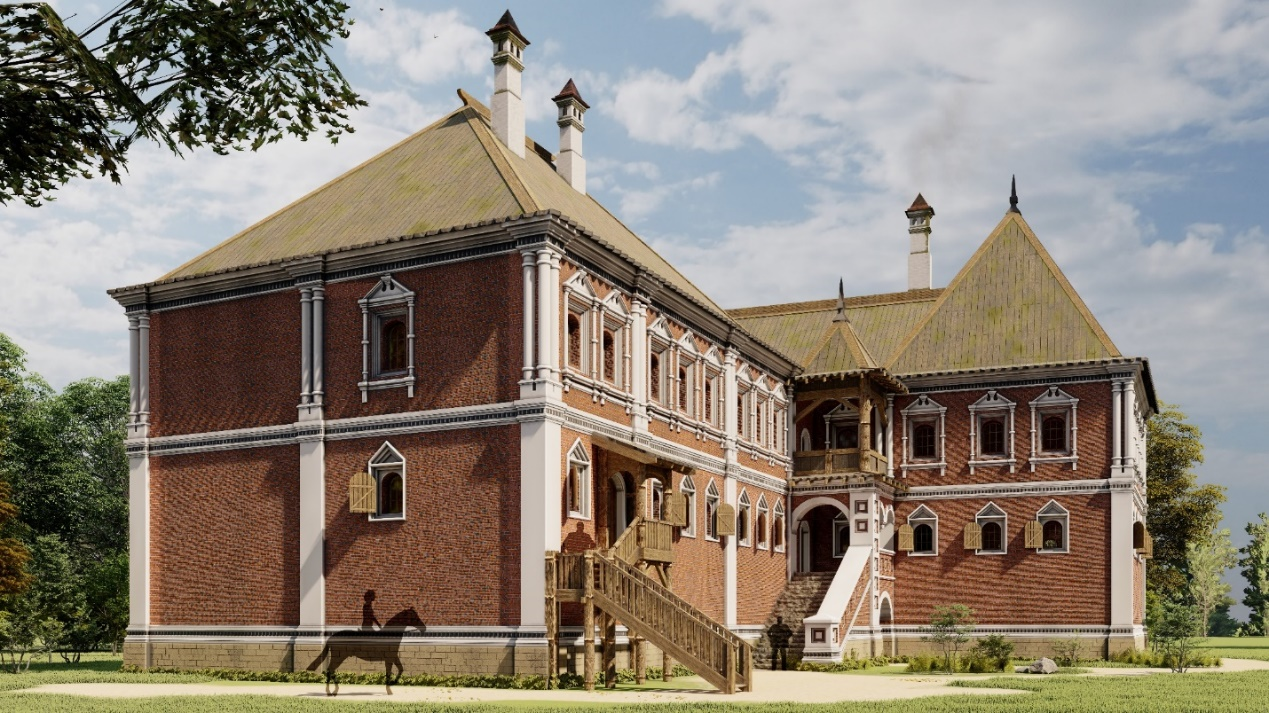
Fig. 4. Visualization of the virtual reconstruction of Lopukhin chamber on the territory of the Bely Gorod (18th century)
It should be noted that the relief of the Bely Gorod is rather complicated, the elevation difference here reaches several dozens meters, which required the creation of a three-dimensional map of this relief using the software capabilities of QGIS (Entin 2019). Fig. 5 shows a virtual reconstruction of the landscape of Bely Gorod, reflecting its parceling in the second half of the 18th century. The features of the relief were carefully taken into account in the process of virtual reconstruction of the Ivanovsky monastery – the main dominant object (ensemble) on the territory of the Bely Gorod, located on the Ivanovskaya hill (this is one of the seven hills of Moscow), Fig. 6. The final stage of the project is associated with the use of virtual and augmented reality (VR / AR) technology.
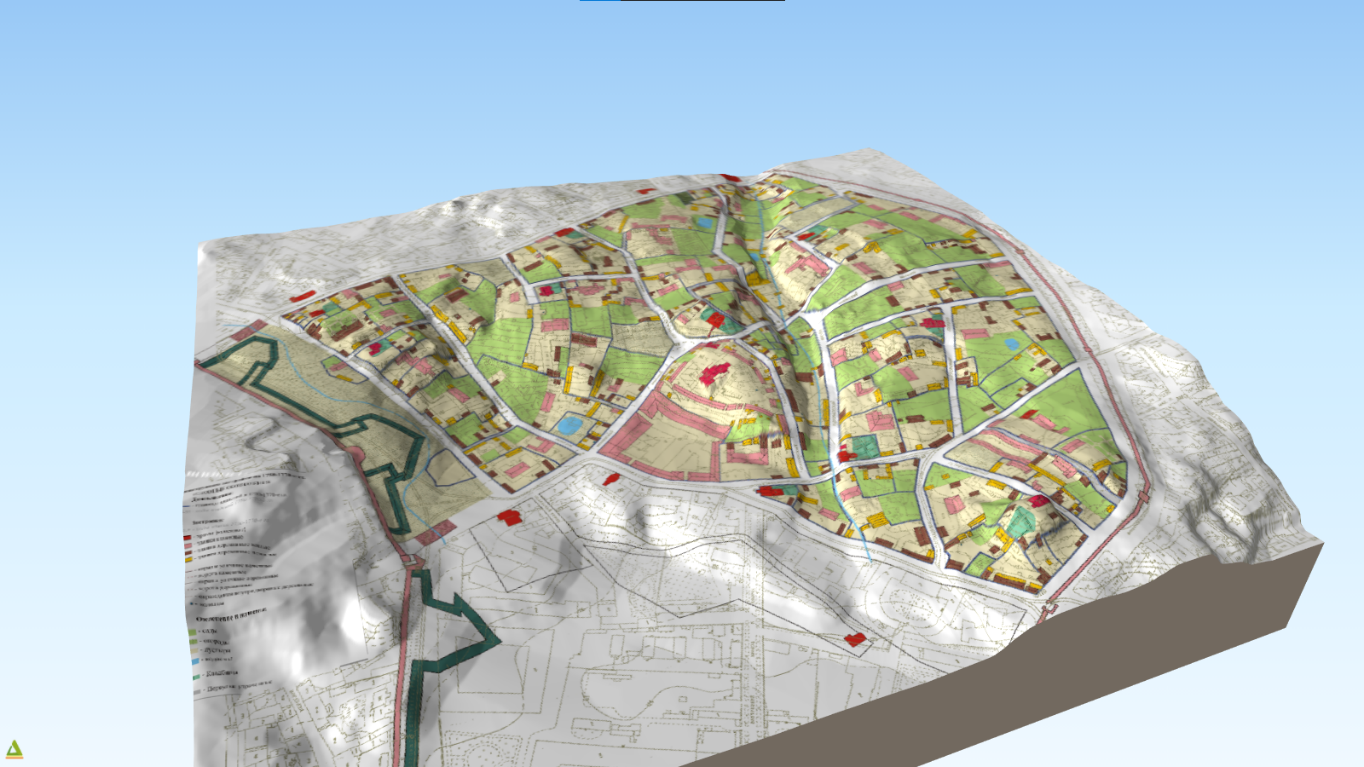
Fig. 5. Virtual 3D-reconstruction of the landscape of the eastern part of Bely Good, reflecting its parceling in 18th century (built in QGIS program)
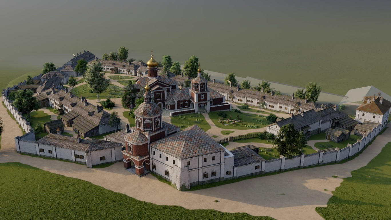
Fig. 6. Visualization of the virtual reconstruction of the Ivanovsky monastery in the 18th century)
All relevant sources, 3D-models, visual tours are represented at the project website (Landscape Project on MSU VR Center 2020).
As a result of this research, a three-dimensional reconstruction of the historical area of the 18th century Moscow is obtained for the first time. This required the involvement of a large number of historical sources of different types and the complex application of a number of digital technologies.